 < back
Tecumseh
next >

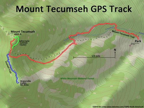
| Here is our GPS track, going to both the summit and the top of the Waterville Valley Ski Area. We go up the Mount Tecumseh Trail (red), down the alternate summit route (green) and over to the ski area on the Sosman Trail (blue). |