 < back
Goves
next >

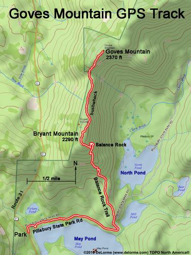
| Here is our GPS track from car to summit. We road walk, trail hike and bushwhack to both Bryant Mountain and a sub-peak of Goves Mountain. (The true summit is under the "T" of "Track".) The woods are open and friendly, making for a fun day. |