 < back
Evans
next >

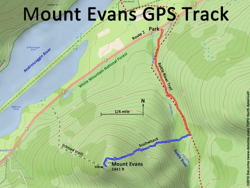
| Here is my GPS track from car to viewpoint. I hike the Rattle River Trail (red), then bushwhack (blue) up to the summit. This is actually a fairly easy hike -- my "moderate" rating is merely due to the need for bushwhacking. |