 < back
Chesterfield
next >

|
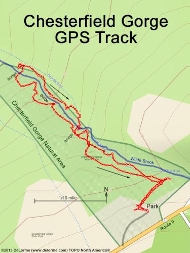
Here is my GPS track, going down brook on the west side,
crossing the far bridge and returning on the east side,
then crossing the near bridge and walking back up via the easier
(away from the brook edge) trail option.
My underlying topo map has Wilde Brook misnamed and misplaced, so I drew in a little-more-accurate depiction in wide blue. |